Thinking about a new build or a savvy investment in Inlet Beach? You are not alone. The neighborhood is evolving, with classic cottages sitting beside fresh small-lot homes, townhome enclaves, and compact mixed-use at the 98/30A gateway. The key is understanding how local rules shape what can be built and where. In this guide, you will learn the zoning overlays, design controls, and due diligence steps that help you buy or build with confidence. Let’s dive in.
What is changing now
Inlet Beach follows the Inlet Beach Neighborhood Plan (NP‑7), an overlay that guides building form, streetscapes, and where higher-intensity projects fit. It sits on top of the Walton County Land Development Code and aims to preserve character while allowing thoughtful infill and small mixed-use nodes. You must meet both sets of rules, which is why planning shapes so much of the product here. You can review the overlay in the county’s official Inlet Beach Neighborhood Plan document.
Recent approvals show a clear pattern. The county has supported small-lot subdivisions, such as the Inlet Cove plat, which created 12 single-family lots on about 1.45 acres north of US‑98. That averages roughly 0.12 acres per lot, a practical snapshot of today’s infill scale. At the same time, the market remains high value and relatively low inventory. Early 2026 data show the 32461 area posting a median sale price around $1.3 million, so even with new inventory, price sensitivity is real.
The rules that shape building
The neighborhood overlay
The Inlet Beach Neighborhood Plan is an overlay implemented through the Walton County Land Development Code. It sets district-level standards for architecture, streets, and compatibility so that new construction supports a walkable coastal look and feel. Developers and owners must comply with both the base zoning and the overlay’s added rules. You can review the official plan in the county’s document center at the Inlet Beach Neighborhood Plan.
Density limits by location
Density changes depending on which side of US‑98 you are on and what utilities serve the site.
- North of US‑98: maximum residential density is no more than 8 dwelling units per acre. Always cross-check the Inlet Beach Neighborhood Plan map for any parcel flagged as “Maximum 8 DUA.”
- South of US‑98: the plan caps density at 4 dwelling units per acre with central water and sewer, and 3 dwelling units per acre if only central water is available.
These caps are the foundation for whether a parcel can be subdivided for small-lot homes or considered for a townhome block.
Heights and design cues
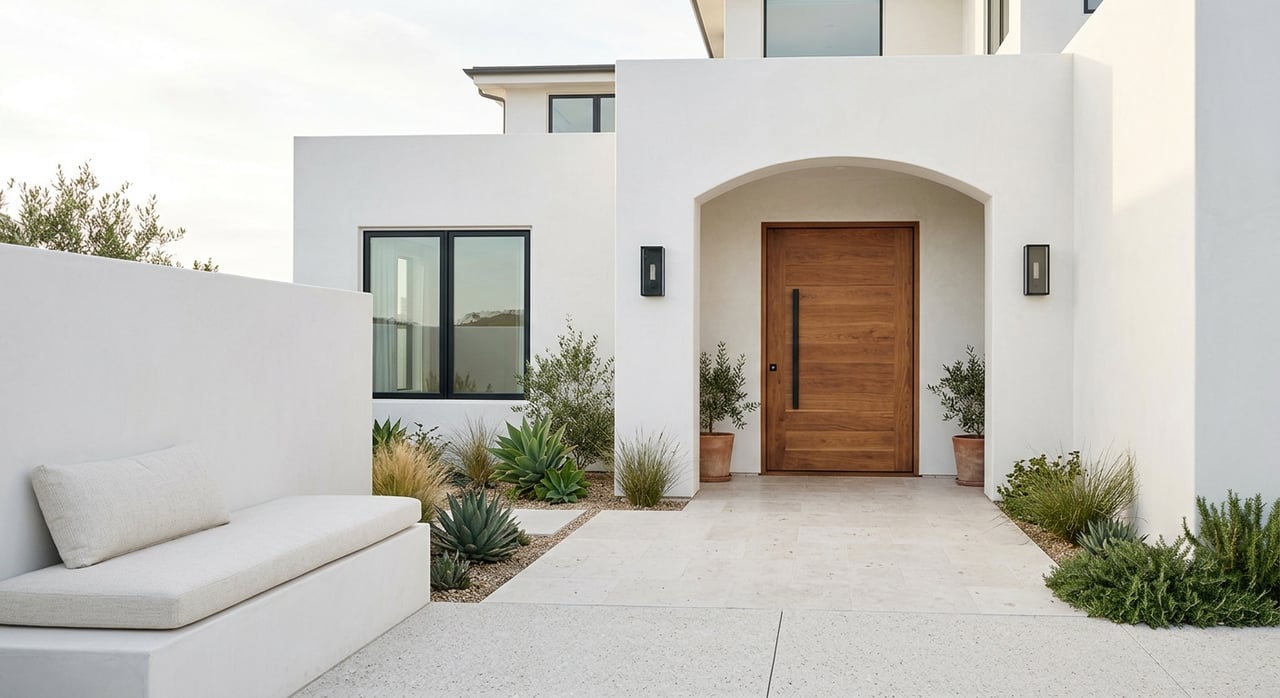
The overlay adds design guidance that keeps a coastal cottage character across many streets. Single-family heights may go up to 50 feet, while multi-family may go up to 40 feet, and taller projects must provide compatibility setbacks next to low-rise preservation areas. The plan encourages street-facing porches, sidewalks with development, limited driveway widths, and side or rear parking so garages do not dominate facades. These requirements affect house plans, garage placement, and build cost.
Live-work opportunities
Inlet Beach has a unique Live‑Work overlay that allows a residential form with limited non-residential use. Non-residential space must be 50 percent or less of the building’s square footage. The overlay caps residential density at 8 dwelling units per acre, with a floor area ratio of 0.50 and an impervious surface ratio of 0.60. This can fit small creative practices or boutique services that serve nearby homes while preserving a residential feel.
Where growth concentrates
Small-lot infill north of US‑98
Expect the most active small-lot infill on parcels north of US‑98 that can connect to central water and sewer. The Inlet Cove plat is a clear example: 12 single-family lots on about 1.45 acres using Neighborhood Infill standards and utility connections. That pattern is repeating on older, larger parcels that can be efficiently subdivided under the overlay.
Townhome enclaves and attached product
Townhomes remain attractive because they reduce per‑unit land cost and deliver more front doors on smaller footprints. You will find attached units with lots often well under 0.1 acre, especially in projects delivered from 2018 to 2024 and continuing. These typically fit in Neighborhood Infill or other residential/mixed districts and help expand both owner-occupied and rental inventory.
Mixed-use at the 98/30A node
Commercial and mixed-use continue to cluster near US‑98, where the Village Mixed Use district and the US‑98 Scenic Corridor Overlay apply. The scenic corridor extends roughly 400 feet from the right-of-way and adds rules for signage, rooflines, landscaping, and parking location. Projects like the 30A Surf Club illustrate how these standards refine building form, access, and streetscape quality without blocking redevelopment.
Natural and infrastructure constraints
Dunes and coastal lake protections
Inlet Beach is shaped by protected dunes and Lake Powell, a coastal dune lake. The neighborhood plan and the county’s resource rules limit development near dunes and coastal dune lakes and increase attention to stormwater design. If you are close to the shore or the lake, expect more involved permitting and potential reductions to buildable area. The official Inlet Beach Neighborhood Plan outlines these protections and how they influence site planning.
Flood and evacuation planning
Flood maps and evacuation zones are a routine part of due diligence that can affect base flood elevations, insurance costs, and construction timelines. For example, the Inlet Cove staff report lists the FEMA panel and notes the site lies in Evacuation Zone B. Expect the county and your builder to set habitable floor elevations accordingly and plan for longer lead times where floodplain rules apply.
Utilities shape feasibility
Density and timing often hinge on connections to central water and sewer. Parcels with proven capacity and clear connection paths are most likely to realize higher allowed densities. The county’s action transferring the Inlet Beach Water System franchise to Regional Utilities signals operational changes that matter for future capacity, connection terms, and schedules. Staff reports and plats typically state which utility provider will serve a project and whether a connection is secured.
What this means for you
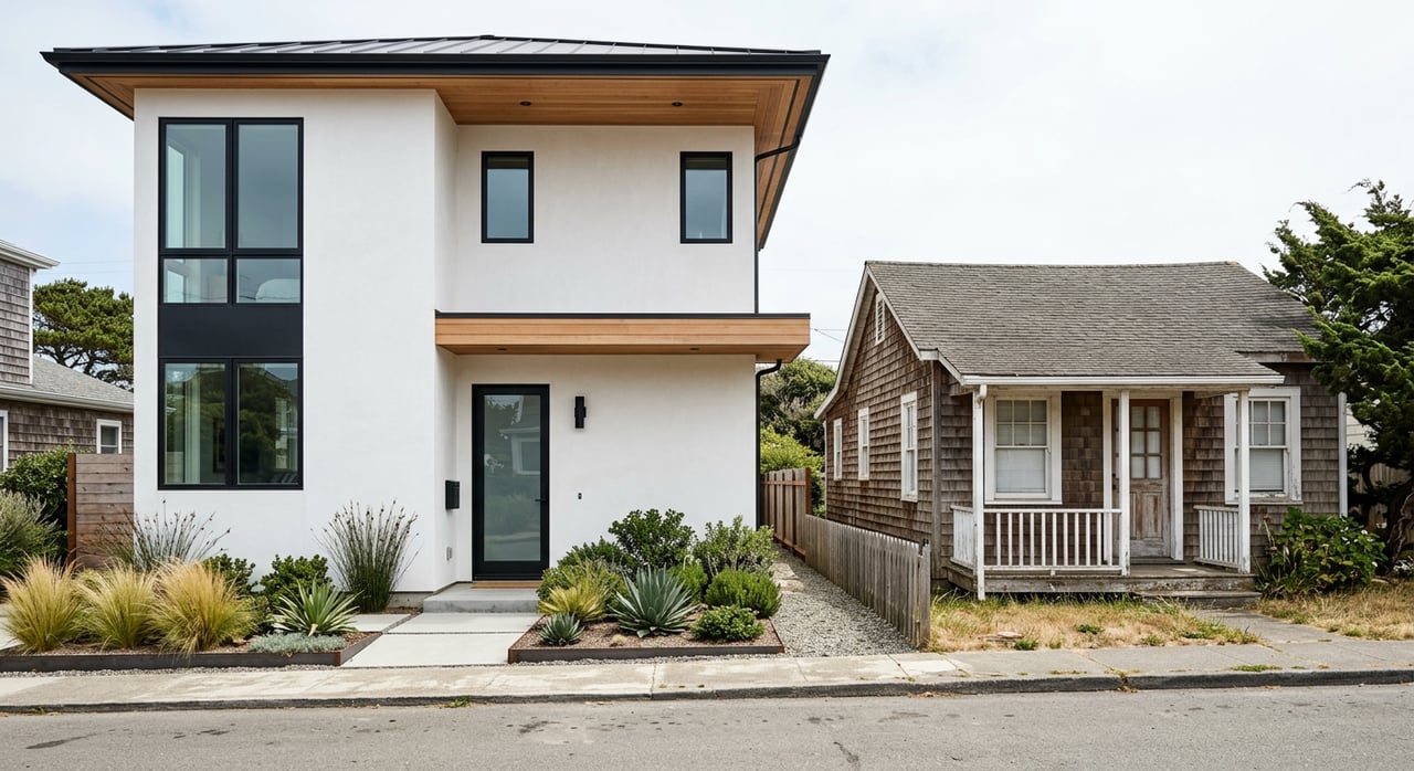
If you want a new single-family home, you will see more small-lot opportunities north of US‑98, with designs that favor porches, pedestrian character, and hidden garages. In preservation-heavy pockets, plan on a cottage-forward look and compatibility setbacks next to lower-rise neighbors. Modern, boxy designs may need façade treatments to meet the overlay’s character.
If you are considering an attached product, townhomes can be a smart way to enter the market or diversify a portfolio. Smaller lots and efficient footprints tend to deliver better price-per-square-foot dynamics and can be strong performers when paired with good design and walkable settings.
If you are underwriting a rental property, be sure to include compliance costs. Walton County’s Vacation Rental Registration Program requires annual registration and sets penalties for operating without a license. Add inspections, renewals, and any HOA rules to your model. With a median sale price around $1.3 million in 32461 and limited inventory, conservative assumptions and longer hold periods can help manage risk.
Buyer and investor due diligence
Use this quick checklist to evaluate a parcel or project:
- Confirm zoning and overlays. Check base zoning and the Inlet Beach Neighborhood Plan designation in Walton County resources so you understand density, height, and design controls. Start with the Land Development Code portal.
- Pull staff reports and plats. Look for an existing Development Order, conditions, or prior approvals. The Inlet Cove packet is a good example of the details these documents contain.
- Verify utilities. Confirm water and sewer provider, capacity, and any connection agreements or assessments. Review recent county actions on utility franchises and service changes.
- Check flood and evacuation status. Identify FEMA panels, required base flood elevations, and whether the site lies in an evacuation zone. Staff reports typically list these items.
- Confirm rental licensing. If you plan to operate a vacation rental, review Walton County’s Vacation Rental Registration requirements, fees, and compliance steps.
- Review HOAs and covenants. Obtain CC&Rs early. Some communities limit rentals or require certain design standards that exceed county code.
- Identify site constraints. Assess stormwater, soils, tree protection, dunes, and coastal lake setbacks. County staff comments often flag these items early in the process.
Outlook for 2026
Expect more of the same core pattern: small-lot infill where utilities and density allow, attached products that respect walkability and façade design, and compact mixed-use shaped by the scenic corridor standards. The county is actively refining the neighborhood plan through targeted text updates and cleanup items, which reflects ongoing attention to compatibility in long-established cottage areas. Keeping an eye on these policy adjustments will help you time acquisitions and dial in design before you break ground.
Ready to explore opportunities or validate a site against the overlay rules? Reach out for a tailored, research-forward plan for your goals. Connect with the team at LaFlure & Vice for a personalized consultation.
FAQs
Can you build a three-story rental anywhere in Inlet Beach?
- No. The neighborhood plan and the Land Development Code set height limits and require compatibility setbacks next to low-rise areas. Always confirm the parcel’s district and review the Inlet Beach Neighborhood Plan before you design.
Are short-term rentals allowed in Inlet Beach, and can HOAs restrict them?
- Yes, short-term rentals are allowed subject to Walton County’s Vacation Rental Registration Program. HOAs can adopt stricter rules in their covenants, so check both county licensing and community documents.
How small do infill lots get in practice in Inlet Beach?
- A recent reference point is the Inlet Cove plat, which created 12 single-family lots on about 1.45 acres, or roughly 0.12 acres per lot on average.
Does the US‑98 Scenic Corridor Overlay prevent commercial redevelopment at the 98/30A node?
- No. It adds architectural, signage, landscaping, and parking controls that shape design and access. Projects that meet these criteria can proceed, as shown in the 30A Surf Club staff review.
Where is higher residential density most likely to be allowed?
- Parcels north of US‑98 that can connect to central water and sewer and that meet the Inlet Beach Neighborhood Plan density caps are the strongest candidates. Always cross-check the official overlay map and the parcel’s base zoning before you underwrite.